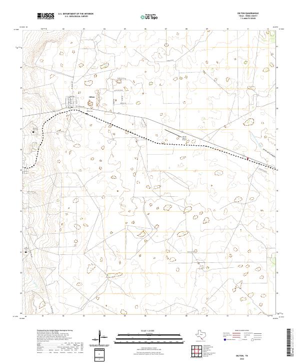
2022 Map of Oilton
USGS Topo · Published 2022About this map
Oilton serves as the central hub of this South Texas landscape, where a grid of streets including Ramona Ave and E Laredo Ave meet the broader transit corridors of Webb County. The map documents several significant burial sites for local genealogy, including the Oilton Cem just south of the main townsite, the Mirando City Cem to the west, and the Los Ojuelos Cem further south. These sites, often tied to long-standing ranching families, provide a vital record of the area's settlement history. The terrain is defined by ephemeral waterways such as Ryo Cr and the Arroyo de los Angles, which drain the scrubland between expansive ranch properties. Aviation infrastructure is represented by the Van Es Ranch Airport, highlighting the role of private flight in managing the vast distances of the Rio Grande plains.
Find a feature on this map
25 named features on this map. Tap any name to fly to it.
Don’t see what you’re looking for? This feature index may not catch every label — zoom into the map to look around manually.
Map Details
Editions of this 2022 Oilton Map
This is the sole edition of this map. No revisions or reprints were ever made.
Other maps of this area

1937 · Aguilete Creek
USGS Topo · 1:62,500

1939 · Bruni
USGS Topo · 1:62,500

1940 · Aguilares
USGS Topo · 1:62,500

1956 · Laredo
USGS Topo · 1:250,000
1968 · Mills Bennett SW
USGS Topo · 1:24,000

1968 · San Pablo
USGS Topo · 1:24,000

1972 · Albercas Ranch
USGS Topo · 1:24,000

1972 · Bruni SE
USGS Topo · 1:24,000
1972 · Bruni
USGS Topo · 1:24,000
1972 · Oilton
USGS Topo · 1:24,000