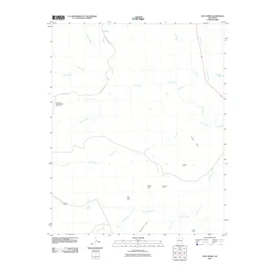
2010 Map of Ojito Spring
USGS Topo · Published 2010About this map
Marquez Ranch and the small settlement of Los Posos anchor this high-desert landscape in Sandoval County, defined by a complex network of arroyos and distinct mesa formations. The terrain is dominated by the broad rises of Cucho Mesa and Bernalillito Mesa, separated by drainage systems like Arroyo Cucho and Arroyo Bernalillito. Resource extraction and water management are primary features of the area's development, evidenced by the presence of the Polka Dot Uranium Group and Yellow Cliffs Group mining interests. Hydrological engineering is also prominent, with the Rio Salado Detention Dam Number 18 situated near the western edge. Reliable water sources in this arid environment are specifically marked by the namesake Ojito Spring and several livestock watering points including Ojito Tank and Peñasco Tank. Navigational access is facilitated by Indian Service Route 3 and Ridge Road 113, which cross the winding course of the Rio Salado.
Find a feature on this map
29 named features on this map. Tap any name to fly to it.
Don’t see what you’re looking for? This feature index may not catch every label — zoom into the map to look around manually.
Map Details
Editions of this 2010 Ojito Spring Map
This is the sole edition of this map. No revisions or reprints were ever made.
Other maps of this area

1883 · Mt. Taylor
USGS Topo · 1:250,000

1886 · Mt. Taylor
USGS Topo · 1:250,000

1888 · Bernalillo
USGS Topo · 1:125,000

1889 · Albuquerque
USGS Topo · 1:125,000

1890 · Jemes
USGS Topo · 1:125,000

1892 · Jemes
USGS Topo · 1:125,000

1892 · Mt. Taylor
USGS Topo · 1:250,000

1893 · Albuquerque
USGS Topo · 1:125,000

1899 · Mt. Taylor
USGS Topo · 1:250,000

1939 · San Ysidro
USGS Topo · 1:62,500