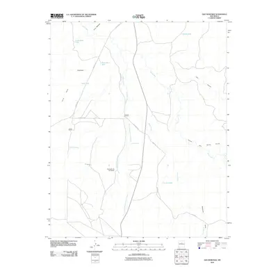
2010 Map of Ojo Hedionda
USGS Topo · Published 2010About this map
Anaya Ranch and the small settlement of Puertacito de los Salado characterize this arid landscape in Santa Fe County, where water management is central to the local geography. The area is defined by numerous drainage systems, most notably the winding Arroyo Jara and the Arroyo Puertacito de los Salado, which cut through the terrain. A network of livestock infrastructure, including Little Jara Windmill and several catchment basins like Horse Shoe Tank and La Jara Tank, indicates the ongoing importance of ranching in this high-desert environment.
Find a feature on this map
24 named features on this map. Tap any name to fly to it.
Don’t see what you’re looking for? This feature index may not catch every label — zoom into the map to look around manually.
Map Details
Editions of this 2010 Ojo Hedionda Map
This is the sole edition of this map. No revisions or reprints were ever made.
Other maps of this area

1892 · San Pedro
USGS Topo · 1:125,000

1894 · Lamy
USGS Topo · 1:125,000

1954 · Santa Fe
USGS Topo · 1:250,000

1956 · Edgewood
USGS Topo · 1:62,500

1958 · Santa Fe
USGS Topo · 1:250,000

1958 · Albuquerque
USGS Topo · 1:250,000

1960 · Stanley
USGS Topo · 1:62,500

1961 · Madrid
USGS Topo · 1:62,500

1962 · Albuquerque
USGS Topo · 1:250,000
1963 · Albuquerque
USGS Topo · 1:250,000