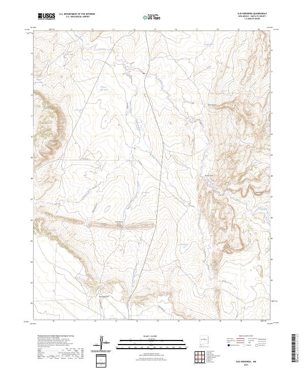
2023 Map of Ojo Hedionda
USGS Topo · Published 2023About this map
Ojo Hedionda sits at the heart of this high-desert landscape in Santa Fe County, defined by a complex network of arroyos and ranching infrastructure. The terrain is dominated by drainage patterns that flow through Hub Canyon and across the White Bluffs, with seasonal water management evident in numerous named basins such as Coyote Tank, La Jara Tank, and Horse Shoe Tank. These features reflect the long-standing importance of water rights and livestock management in this arid region.
Find a feature on this map
25 named features on this map. Tap any name to fly to it.
Don’t see what you’re looking for? This feature index may not catch every label — zoom into the map to look around manually.
Map Details
Editions of this 2023 Ojo Hedionda Map
This is the sole edition of this map. No revisions or reprints were ever made.
Other maps of this area

1892 · San Pedro
USGS Topo · 1:125,000

1894 · Lamy
USGS Topo · 1:125,000

1954 · Santa Fe
USGS Topo · 1:250,000

1956 · Edgewood
USGS Topo · 1:62,500

1958 · Santa Fe
USGS Topo · 1:250,000

1958 · Albuquerque
USGS Topo · 1:250,000

1960 · Stanley
USGS Topo · 1:62,500

1961 · Madrid
USGS Topo · 1:62,500

1962 · Albuquerque
USGS Topo · 1:250,000
1963 · Albuquerque
USGS Topo · 1:250,000