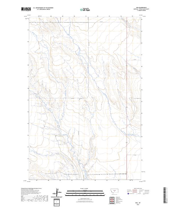
2024 Map of Oka
USGS Topo · Published 2024About this map
Antelope Creek and Roberts Creek carve through this Wheatland County landscape, illustrating a drainage pattern typical of the Montana plains. The topography is defined by significant elevation changes between the creek beds and the high township plateaus, with Alkali Creek cutting across the southern reaches of the map. Human imprint on this rural expanse is sparse, primarily marked by the presence of Lode Reservoir, which suggests a history of water management for local agricultural or livestock needs. A few essential transit corridors, such as Old Gap Rd and Access Rd, provide the only named overland passage through these sprawling township and range sections.
Find a feature on this map
10 named features on this map. Tap any name to fly to it.
Don’t see what you’re looking for? This feature index may not catch every label — zoom into the map to look around manually.
Map Details
Editions of this 2024 Oka Map
This is the sole edition of this map. No revisions or reprints were ever made.
Other maps of this area

1889 · Big Snowy Mountain
USGS Topo · 1:250,000

1893 · Big Snowy Mountain
USGS Topo · 1:250,000

1954 · Roundup
USGS Topo · 1:250,000

1958 · Roundup
USGS Topo · 1:250,000
1986 · Oka
USGS Topo · 1:24,000
1986 · Mead Creek
USGS Topo · 1:24,000
1986 · Judith Gap
USGS Topo · 1:24,000
1986 · Hopley Creek North
USGS Topo · 1:24,000
1986 · Oxford
USGS Topo · 1:24,000
1986 · Harlowton
USGS Topo · 1:24,000