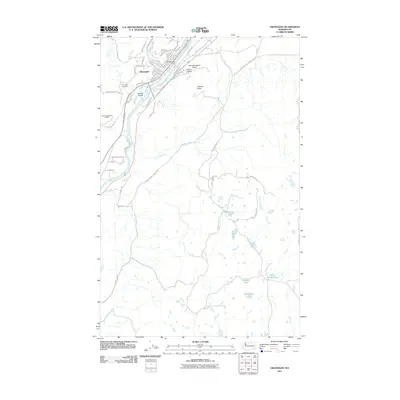
2011 Map of Okanogan
USGS Topo · Published 2011About this map
Okanogan serves as the focal point of this 2011 survey, situated along the western banks of the Okanogan River. The town's grid is detailed with numerous local roads like Conconully Rd and Railroad Ave, centering on the Okanogan Post Office. The surrounding landscape is defined by the river’s winding course, featuring Woody Island and the elevated landmark of Jackass Butte to the east.
Find a feature on this map
58 named features on this map. Tap any name to fly to it.
Don’t see what you’re looking for? This feature index may not catch every label — zoom into the map to look around manually.
Map Details
Editions of this 2011 Okanogan Map
This is the sole edition of this map. No revisions or reprints were ever made.
Other maps of this area

1905 · Okanogan
USGS Topo · 1:125,000

1950 · Boot Mtn
USGS Topo · 1:62,500

1953 · Omak Lake
USGS Topo · 1:62,500

1954 · Okanogan
USGS Topo · 1:250,000

1957 · Okanogan
USGS Topo · 1:62,500

1957 · Bridgeport
USGS Topo · 1:62,500

1958 · Okanogan
USGS Topo · 1:250,000

1980 · Okanogan
USGS Topo · 1:24,000
1980 · Omak
USGS Topo · 1:24,000
1980 · Joe Lake
USGS Topo · 1:24,000