
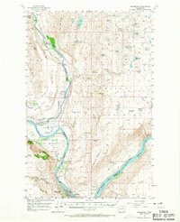
1957 Map of Bridgeport
USGS Topo · Published 1958About this map
Columbia River geography defines this 1957 landscape, where the construction of the Chief Joseph dam transformed the river into Rufus Woods Lake. The map captures a critical transition in the region's history, documenting the remains of early commerce at the Ft Okanogan (Site) and Ft Okanogan (Site 2), established near the confluence with the Okanogan River. Settlement patterns follow the Great Northern rail line through Wakefield and Monse, while the town of Bridgeport sits at a strategic crossing point above the plateau.
Find a feature on this map
59 named features on this map. Tap any name to fly to it.
Don’t see what you’re looking for? This feature index may not catch every label — zoom into the map to look around manually.
Map Details
Editions of this 1957 Bridgeport Map
2 editions found
Other maps of this area

1905 · Okanogan
USGS Topo · 1:125,000

1950 · Boot Mtn
USGS Topo · 1:62,500

1953 · Omak Lake
USGS Topo · 1:62,500

1953 · Ritzville
USGS Topo · 1:250,000

1954 · Okanogan
USGS Topo · 1:250,000

1956 · Loup Loup
USGS Topo · 1:62,500

1957 · Okanogan
USGS Topo · 1:62,500

1957 · Brewster
USGS Topo · 1:62,500

1958 · Okanogan
USGS Topo · 1:250,000

1959 · Ritzville
USGS Topo · 1:250,000