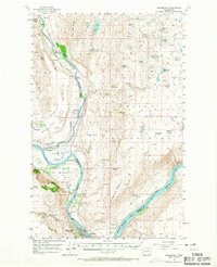
1957 Map of Bridgeport
USGS Topo · Published 1967About this map
The Columbia River serves as the central artery for this mid-century landscape, dividing Okanogan Co from Douglas Co and defining the local economy and geography. On the northern banks, the Colville Indian Reservation encompasses high terrain like Soap Lake Mountain and the water-filled basins of Soap Lake and Little Soap Lake. Historically significant sites are clustered near the river confluence, including the Indian Cem and two distinct locations for the Ft Okanogan outpost. Transport is dominated by the Great Northern railroad line following the river's path through Wakefield and Monse. To the south, the development of Rufus Woods Lake and Bridgeport State Park signals the era's transformation of the river into a managed reservoir system, while local infrastructure such as the Bedard Sch (Aband'd) and Snider Flat reflect the dispersed agricultural and ranching history of the area.
Find a feature on this map
51 named features on this map. Tap any name to fly to it.
Don’t see what you’re looking for? This feature index may not catch every label — zoom into the map to look around manually.
Map Details
Editions of this 1957 Bridgeport Map
2 editions found
Other maps of this area

1905 · Okanogan
USGS Topo · 1:125,000

1950 · Boot Mtn
USGS Topo · 1:62,500

1953 · Omak Lake
USGS Topo · 1:62,500

1953 · Ritzville
USGS Topo · 1:250,000

1954 · Okanogan
USGS Topo · 1:250,000

1956 · Loup Loup
USGS Topo · 1:62,500

1957 · Okanogan
USGS Topo · 1:62,500

1957 · Bridgeport
USGS Topo · 1:62,500

1957 · Brewster
USGS Topo · 1:62,500

1958 · Okanogan
USGS Topo · 1:250,000