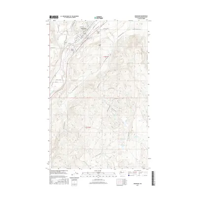
2017 Map of Okanogan
USGS Topo · Published 2017About this map
Okanogan sits at the northern edge of this landscape, its street grid organized alongside the Okanogan River and the Railroad Avenue corridor. The geography here is defined by sharp elevation changes, rising from the riverbanks to prominent heights like Wood Hill and Jackass Butte. In the southern reaches of the quadrangle, a high plateau is dotted with numerous small water bodies, including Cameron Lake, Spiegelberg Lake, and Rimrock Lake.
Find a feature on this map
53 named features on this map. Tap any name to fly to it.
Don’t see what you’re looking for? This feature index may not catch every label — zoom into the map to look around manually.
Map Details
Editions of this 2017 Okanogan Map
This is the sole edition of this map. No revisions or reprints were ever made.
Other maps of this area

1905 · Okanogan
USGS Topo · 1:125,000

1950 · Boot Mtn
USGS Topo · 1:62,500

1953 · Omak Lake
USGS Topo · 1:62,500

1954 · Okanogan
USGS Topo · 1:250,000

1957 · Okanogan
USGS Topo · 1:62,500

1957 · Bridgeport
USGS Topo · 1:62,500

1958 · Okanogan
USGS Topo · 1:250,000

1980 · Okanogan
USGS Topo · 1:24,000
1980 · Omak
USGS Topo · 1:24,000
1980 · Joe Lake
USGS Topo · 1:24,000