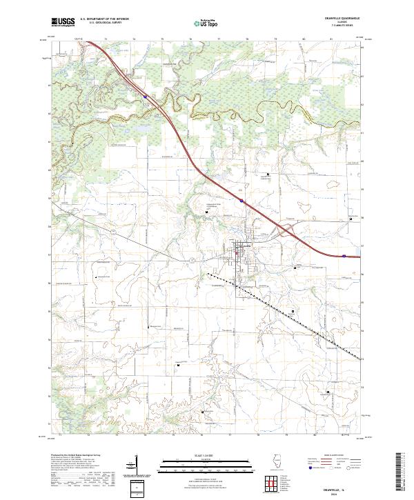
2024 Map of Okawville
USGS Topo · Published 2024About this map
Okawville serves as the central hub of this Southern Illinois landscape, situated at a junction where the town grid meets a complex network of wetlands and river systems. The Kaskaskia River meanders across the northern portion of the map, creating a mosaic of oxbows and backwaters such as Horseshoe Lake, Hospital Lake, and Benson Slough. This fluvial environment is flanked by the Clinton Co and Washington Co boundary, which follows the old river course. Away from the river, the terrain transitions to a highly structured agricultural landscape punctuated by family and fraternal burial grounds. These sites, including the Independent Order of Oddfellows Cem, Husemann Cem, and Kinyon Cem, provide a dense record of the area's ancestral settlement patterns. The southern reaches are defined by the winding path of Plum Creek and a network of rural roads with distinctive avian names like Cardinal Rd and Hummingbird Rd.
Find a feature on this map
102 named features on this map. Tap any name to fly to it.
Don’t see what you’re looking for? This feature index may not catch every label — zoom into the map to look around manually.
Map Details
Editions of this 2024 Okawville Map
This is the sole edition of this map. No revisions or reprints were ever made.
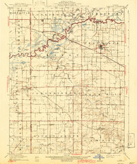
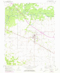
Historical Maps of Clinton County Through Time
4 maps found