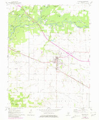
1962 Map of Okawville
USGS Topo · Published 1981About this map
The Kaskaskia River and Shoal Creek define the northern landscape of this region, creating a complex network of oxbow lakes and wetlands such as Horseshoe L, Twin Lakes, and Swan Lake. This 1962 survey reveals a rural society structured around the Louisville and Nashville railroad, which bisects the territory and connects the primary hub of Okawville with the smaller Venedy Station.
Find a feature on this map
60 named features on this map. Tap any name to fly to it.
Don’t see what you’re looking for? This feature index may not catch every label — zoom into the map to look around manually.
Map Details
Editions of this 1962 Okawville Map
2 editions found
Other maps of this area

1906 · Breese
USGS Topo · 1:62,500

1907 · Breese
USGS Topo · 1:62,500

1910 · Carlyle
USGS Topo · 1:62,500

1910 · Okawville
USGS Topo · 1:62,500

1931 · Hoyleton
USGS Topo · 1:48,000

1932 · Nashville
USGS Topo · 1:62,500

1936 · Nashville
USGS Topo · 1:62,500

1940 · Okawville
USGS Topo · 1:62,500

1948 · Carlyle
USGS Topo · 1:62,500
1957 · Venedy
USGS Topo · 1:24,000