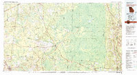
1980 Map of Okefenokee Swamp
USGS Topo · Published 1981About this map
The vast wetlands of the Okefenokee National Wildlife Refuge dominate this landscape, showing the complex hydrology of the Suwannee River and St Marys River headwaters. The map illustrates a distinctive pattern of "islands" and "prairies" within the swamp, including Billys Island, Honey Island, and the expansive Grand Prairie. To the east, the prominent Trail Ridge forms a natural boundary that separates the swamp from the coastal plain.
Find a feature on this map
75 named features on this map. Tap any name to fly to it.
Don’t see what you’re looking for? This feature index may not catch every label — zoom into the map to look around manually.
Map Details
Editions of this 1980 Okefenokee Swamp Map
This is the sole edition of this map. No revisions or reprints were ever made.
Other maps of this area

1917 · Nahunta
USGS Topo · 1:62,500

1917 · Cambon
USGS Topo · 1:62,500

1917 · Boulogne
USGS Topo · 1:62,500

1917 · Macclenny
USGS Topo · 1:62,500

1917 · Hilliard
USGS Topo · 1:62,500

1918 · Folkston
USGS Topo · 1:62,500

1918 · Moniac
USGS Topo · 1:62,500

1918 · Nahunta
USGS Topo · 1:62,500

1918 · Cambon
USGS Topo · 1:62,500

1918 · Macclenny
USGS Topo · 1:62,500