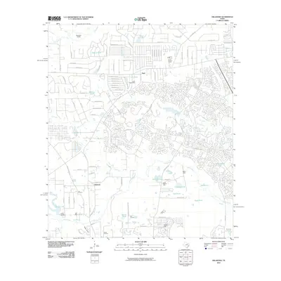
2010 Map of Oklahoma
USGS Topo · Published 2010About this map
Oklahoma and Egypt sit at the center of this Montgomery County landscape, where suburban expansion meets legacy oil extraction. The 2010 terrain is defined by an intricate network of residential streets and cul-de-sacs, such as Wind Crest Estates Blvd and Woodlands Pkwy, woven between established industrial sites like the Tamina Arcenaut Oil Field and the Indian Hills Oil Field. Water remains a dominant feature of the geography, with Spring Creek meandering across the southern portion of the sheet and numerous smaller bodies like Lake Egypt and Mayhaw Pond dotting the residential developments. The area's heritage is preserved in several local burial grounds, including Pate Cemetery, Zion Cemetery, and McCall Cemetery, providing critical landmarks for genealogists and local historians tracing the evolution of this region from rural oil fields to a major suburban hub.
Find a feature on this map
98 named features on this map. Tap any name to fly to it.
Don’t see what you’re looking for? This feature index may not catch every label — zoom into the map to look around manually.
Map Details
Editions of this 2010 Oklahoma Map
This is the sole edition of this map. No revisions or reprints were ever made.
Other maps of this area

1916 · Rose Hill
USGS Topo · 1:24,000

1916 · Louetta
USGS Topo · 1:24,000

1916 · Spring
USGS Topo · 1:24,000

1920 · Spring
USGS Topo · 1:31,680

1920 · Rose Hill
USGS Topo · 1:31,680

1920 · Louetta
USGS Topo · 1:31,680

1954 · Beaumont
USGS Topo · 1:250,000

1957 · Beaumont
USGS Topo · 1:250,000

1958 · Conroe
USGS Topo · 1:24,000

1958 · Cowl Spur
USGS Topo · 1:24,000