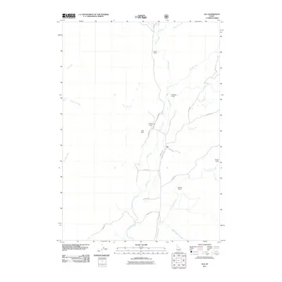
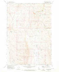
2011 Map of Ola
USGS Topo · Published 2011About this map
Ola sits at a crossroads of valley roads and mountain drainages in this modern study of Gem County. The landscape is defined by the winding course of Squaw Creek, which collects numerous tributaries including Gold Run Creek and Little Squaw Creek. To the west, the prominent elevation of Joes Butte overlooks a series of rugged draws such as Fir Tree Gulch and Currin Gulch. The road network, including the Sweet Ola Hwy and Jacknife Ln, provides a clear view of the rural property divisions and settlement patterns. Notable water sources like Cherry Spring and diverse terrain features like Salmon Gulch illustrate the complex hydrology of this high-desert and foothills environment. The presence of named lanes such as Perkins Ln and Butler Ln offers specific points of interest for those researching the local land use and family history of the area.
Find a feature on this map
32 named features on this map. Tap any name to fly to it.
Don’t see what you’re looking for? This feature index may not catch every label — zoom into the map to look around manually.
Map Details
Editions of this 2011 Ola Map
This is the sole edition of this map. No revisions or reprints were ever made.
Other maps of this area

1894 · Squaw Creek
USGS Topo · 1:125,000

1953 · Smiths Ferry
USGS Topo · 1:62,500

1953 · Banks
USGS Topo · 1:62,500

1955 · Baker
USGS Topo · 1:250,000

1959 · Baker
USGS Topo · 1:250,000

1970 · Dodson Pass
USGS Topo · 1:24,000
1970 · Squaw Butte
USGS Topo · 1:24,000
1970 · Coonrod Gulch
USGS Topo · 1:24,000
1970 · Ola
USGS Topo · 1:24,000
1970 · Riley Butte
USGS Topo · 1:24,000