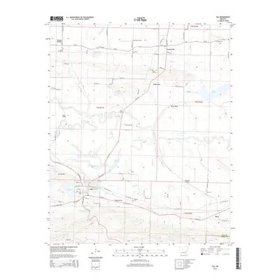
2014 Map of Ola
USGS Topo · Published 2014About this map
Ola and Centerville anchor this Yell County landscape where the Petit Jean River meanders through complex wetlands and sloughs. The river corridor is defined by features like Cane Island Slough and Keeland Slough, illustrating a flood-prone valley that has historically shaped local transport and settlement patterns. Further south, Lake Ola-dale sits at the base of Danville Mtn, providing a stark contrast to the flat bottomlands near Rocky Crossing.
Find a feature on this map
107 named features on this map. Tap any name to fly to it.
Don’t see what you’re looking for? This feature index may not catch every label — zoom into the map to look around manually.
Map Details
Editions of this 2014 Ola Map
This is the sole edition of this map. No revisions or reprints were ever made.
Other maps of this area
1888 · Dardanelle #4
USGS Topo · 1:62,500
1888 · Dardanelle #3
USGS Topo · 1:62,500
1890 · Hot Springs
USGS Topo · 1:125,000

1890 · Dardanelle
USGS Topo · 1:125,000
1894 · Hot Springs
USGS Topo · 1:125,000

1955 · Little Rock
USGS Topo · 1:250,000

1956 · Little Rock
USGS Topo · 1:250,000

1956 · Russellville
USGS Topo · 1:250,000
1960 · Little Rock
USGS Topo · 1:250,000
1964 · Russellville
USGS Topo · 1:250,000