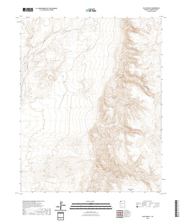
2023 Map of Olaf Knolls
USGS Topo · Published 2023About this map
The Grand Canyon - Parashant National Monument dominates this Mojave County landscape, preserving a transition zone where the high Colorado Plateau meets the lower Mojave Desert. This topographical study highlights the dramatic elevation changes along the Grand Wash Cliffs, which form a massive structural wall through the center of the sheet. The area is protected in part by the Grand Wash Cliffs Wilderness, a region defined by its lack of modern infrastructure, save for isolated routes like Rd 1061. Localized features such as the Olaf Knolls and the drainage of Grand Wash provide specific reference points for researchers tracing the hydrology of the northern Arizona strip. Canyons like Tank Canyon and Red Rock Canyon cut through the rising terrain toward the Grand Gulch Bench, illustrating the complex erosion patterns of this desert plateau.
Find a feature on this map
15 named features on this map. Tap any name to fly to it.
Don’t see what you’re looking for? This feature index may not catch every label — zoom into the map to look around manually.
Map Details
Editions of this 2023 Olaf Knolls Map
This is the sole edition of this map. No revisions or reprints were ever made.
Other maps of this area

1886 · Mt. Trumbull
USGS Topo · 1:250,000

1892 · Mt. Trumbull
USGS Topo · 1:250,000

1953 · Grand Canyon
USGS Topo · 1:250,000

1954 · Littlefield 3 SW
USGS Topo · 1:24,000
1954 · Littlefield 3 SE
USGS Topo · 1:24,000

1954 · Cane Springs
USGS Topo · 1:62,500

1957 · Grand Canyon
USGS Topo · 1:250,000

1958 · Grand Canyon
USGS Topo · 1:250,000

1960 · Grand Canyon
USGS Topo · 1:250,000
1971 · Gyp Hills
USGS Topo · 1:24,000