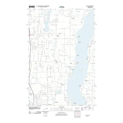
2011 Map of Olalla
USGS Topo · Published 2011About this map
Colvos Passage serves as the dominant waterway for this coastal region of Kitsap and Pierce counties, where steep-banked points and quiet coves define the shoreline. The settlement of Olalla sits at the mouth of Olalla Creek, a historic local hub evidenced by the Olalla Post Office and nearby Al's Marina. The map reveals a landscape transitioned from agricultural roots to a modern residential and recreational network, featuring small airfields like Vaughans Ranch Airport and the Spadoni Brothers Private Airport. To the west, the terrain slopes toward Henderson Bay and the community of Purdy, while the interior is dotted with water bodies like Crescent Lake and Long Lake. Longstanding community markers, such as the Fraola Cemetery near Olalla Valley, provide essential reference points for genealogists tracing family roots in these Puget Sound coastal settlements.
Find a feature on this map
71 named features on this map. Tap any name to fly to it.
Don’t see what you’re looking for? This feature index may not catch every label — zoom into the map to look around manually.
Map Details
Editions of this 2011 Olalla Map
This is the sole edition of this map. No revisions or reprints were ever made.
Other maps of this area

1894 · Seattle
USGS Topo · 1:62,500

1895 · Snohomish
USGS Topo · 1:125,000

1897 · Tacoma
USGS Topo · 1:125,000

1897 · Seattle
USGS Topo · 1:125,000

1900 · Tacoma
USGS Topo · 1:125,000

1908 · Seattle
USGS Topo · 1:62,500

1909 · Seattle Special
USGS Topo · 1:62,500

1937 · Port Orchard
USGS Topo · 1:62,500

1942 · Gig Harbor
USGS Topo · 1:62,500

1943 · Gig Harbor
USGS Topo · 1:62,500