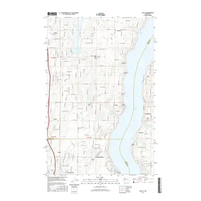
2017 Map of Olalla
USGS Topo · Published 2017About this map
Olalla sits at the head of Olalla Bay on this survey, serving as a focal point for the rural communities along the western shore of the Colvos Passage. The landscape is defined by the narrow waterway separating the mainland from Vashon Island, where the small settlement of Lisabeula and the Cove area are visible. To the west, the map details the headwaters and drainage basins of Burley Cr and Olalla Cr, which carve through the peninsula toward the Puget Sound. In the southern portion of the quadrangle, the community of Maplewood and Crescent Valley appear near Crescent Lake, illustrating the spread of residential development and small-scale agriculture between the inlets. This edition also includes specialized landmarks such as the Fraola Vaughan Ranch Airfield, providing a snapshot of local aviation and private land use within the Kitsap and Pierce County borderlands.
Find a feature on this map
82 named features on this map. Tap any name to fly to it.
Don’t see what you’re looking for? This feature index may not catch every label — zoom into the map to look around manually.
Map Details
Editions of this 2017 Olalla Map
This is the sole edition of this map. No revisions or reprints were ever made.
Other maps of this area

1894 · Seattle
USGS Topo · 1:62,500

1895 · Snohomish
USGS Topo · 1:125,000

1897 · Tacoma
USGS Topo · 1:125,000

1897 · Seattle
USGS Topo · 1:125,000

1900 · Tacoma
USGS Topo · 1:125,000

1908 · Seattle
USGS Topo · 1:62,500

1909 · Seattle Special
USGS Topo · 1:62,500

1937 · Port Orchard
USGS Topo · 1:62,500

1942 · Gig Harbor
USGS Topo · 1:62,500

1943 · Gig Harbor
USGS Topo · 1:62,500