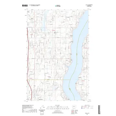
2020 Map of Olalla
USGS Topo · Published 2020About this map
The Colvos Passage carves a deep blue channel through the center of this landscape, separating the mainland of the Great Peninsula from the western shores of Vashon Island. This coastal geography defines the region's character, with small maritime settlements such as Olalla, Fragaria, and Banner clinging to the mainland shoreline. On the island side, Lisabeula and Cove face the passage, highlighting a way of life oriented toward the water. Inland, the terrain is dotted with small water bodies like Long Lake, Mace Lake, and Alder Pond, which feed a network of creeks including Olalla Creek and Fragaria Creek. The presence of the Fraola Cem and the Vaughan Ranch Airfield near the center of the peninsula suggests a community where rural tradition and aviation history intersect. To the south, the expansion of modern residential patterns is visible in the structured road networks of Canterwood and Purdy.
Find a feature on this map
94 named features on this map. Tap any name to fly to it.
Don’t see what you’re looking for? This feature index may not catch every label — zoom into the map to look around manually.
Map Details
Editions of this 2020 Olalla Map
This is the sole edition of this map. No revisions or reprints were ever made.
Other maps of this area

1894 · Seattle
USGS Topo · 1:62,500

1895 · Snohomish
USGS Topo · 1:125,000

1897 · Tacoma
USGS Topo · 1:125,000

1897 · Seattle
USGS Topo · 1:125,000

1900 · Tacoma
USGS Topo · 1:125,000

1908 · Seattle
USGS Topo · 1:62,500

1909 · Seattle Special
USGS Topo · 1:62,500

1937 · Port Orchard
USGS Topo · 1:62,500

1942 · Gig Harbor
USGS Topo · 1:62,500

1943 · Gig Harbor
USGS Topo · 1:62,500