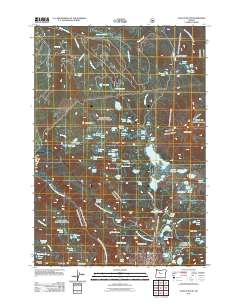
2011 Map of Olallie Butte
USGS Topo · Published 2011About this map
Olallie Butte rises as the dominant landmark in this high-elevation landscape within the Cascade Range. The map reveals an intricate network of alpine hydrology, where the headwaters of the Clackamas River and Olallie Creek originate. Numerous small water bodies such as Si Lake, Surprise Lake, and the cluster of Gifford Lakes are scattered across the terrain, indicating a complex glacial or volcanic geography.
Find a feature on this map
88 named features on this map. Tap any name to fly to it.
Don’t see what you’re looking for? This feature index may not catch every label — zoom into the map to look around manually.
Map Details
Editions of this 2011 Olallie Butte Map
This is the sole edition of this map. No revisions or reprints were ever made.
Other maps of this area

1927 · Mt. Jefferson
USGS Topo · 1:125,000

1930 · Mt. Jefferson
USGS Topo · 1:125,000

1955 · Bend
USGS Topo · 1:250,000

1957 · Bend
USGS Topo · 1:250,000

1958 · Bend
USGS Topo · 1:250,000

1961 · Whitewater River
USGS Topo · 1:62,500

1961 · Fort Butte
USGS Topo · 1:62,500
1961 · Mt. Jefferson
USGS Topo · 1:62,500
1961 · Breitenbush Hot Springs
USGS Topo · 1:62,500
1983 · Madras
USGS Topo · 1:100,000