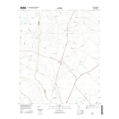
2014 Map of Olar
USGS Topo · Published 2014About this map
Olar and Govan anchor the landscape of Bamberg County in this modern survey, where the Salkehatchie River and Little Salkehatchie River define the local drainage. The map reveals a rural geography shaped by historic family and community landmarks, such as Nimmons Cem near Govan and Starr Cem further south. The area is intersected by a complex network of named creeks, including Georges Cr and Birds Br, which cross the low-lying terrain. The town of Olar serves as a central hub where several highways converge, including the Low Country Hwy. Near the southern boundary, the settlement of Schofield and features like Ocean Pond illustrate the transition into more marshy or pond-heavy environments characteristic of this part of the South Carolina coastal plain. The boundary with Barnwell County is clearly delineated as it follows the course of the Salkehatchie.
Find a feature on this map
79 named features on this map. Tap any name to fly to it.
Don’t see what you’re looking for? This feature index may not catch every label — zoom into the map to look around manually.
Map Details
Editions of this 2014 Olar Map
This is the sole edition of this map. No revisions or reprints were ever made.
Other maps of this area

1919 · Olar
USGS Topo · 1:62,500

1919 · Bamberg
USGS Topo · 1:48,000

1919 · Allendale
USGS Topo · 1:62,500

1920 · Bamberg
USGS Topo · 1:62,500

1923 · Williston
USGS Topo · 1:48,000

1927 · Williston
USGS Topo · 1:62,500

1943 · Olar
USGS Topo · 1:62,500

1943 · Allendale
USGS Topo · 1:62,500

1943 · Bamberg
USGS Topo · 1:62,500

1943 · Williston
USGS Topo · 1:62,500