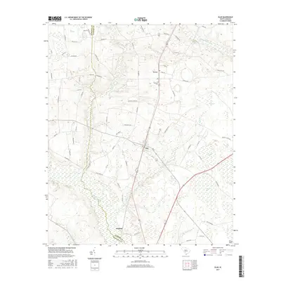
2017 Map of Olar
USGS Topo · Published 2017About this map
Olar and Govan stand as central points of settlement along the border of Barnwell and Bamberg Counties. This landscape is defined by the complex hydrology of the South Carolina Lowcountry, where the Salkehatchie River and the Little Salkehatchie River drain a terrain punctuated by numerous "bays" — elliptical depressional wetlands characteristic of the Atlantic Coastal Plain. These features, such as Alligator Bay, Duck Pond Bay, and Horsepen Bay, create a unique mosaic of wet and dry land that has long influenced local agriculture and road placement.
Find a feature on this map
76 named features on this map. Tap any name to fly to it.
Don’t see what you’re looking for? This feature index may not catch every label — zoom into the map to look around manually.
Map Details
Editions of this 2017 Olar Map
This is the sole edition of this map. No revisions or reprints were ever made.
Other maps of this area

1919 · Olar
USGS Topo · 1:62,500

1919 · Bamberg
USGS Topo · 1:48,000

1919 · Allendale
USGS Topo · 1:62,500

1920 · Bamberg
USGS Topo · 1:62,500

1923 · Williston
USGS Topo · 1:48,000

1927 · Williston
USGS Topo · 1:62,500

1943 · Olar
USGS Topo · 1:62,500

1943 · Allendale
USGS Topo · 1:62,500

1943 · Bamberg
USGS Topo · 1:62,500

1943 · Williston
USGS Topo · 1:62,500