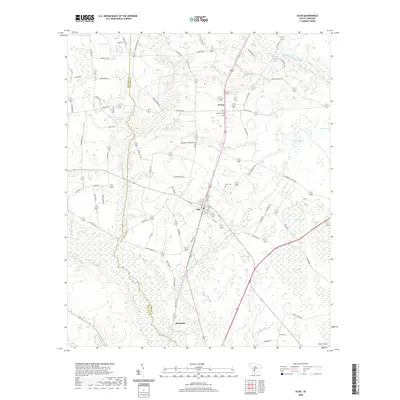
2020 Map of Olar
USGS Topo · Published 2020About this map
The town of Olar sits at the heart of this Bamberg County landscape, where the agricultural legacy of the South Carolina Lowcountry is written across the terrain. Situated along the boundary with Barnwell County, the area is defined by the convergence of the Salkehatchie River and its numerous tributaries and wetland features. To the north, the small settlement of Govan serves as a local landmark near Nimmons Cem, while to the south, the community of Schofield rests near the river's winding path. The map reveals a complex hydrography typical of the region, featuring distinctive named wetlands and bays such as Alligator Bay, Hogpen Bay, and Duck Pond Bay. These natural features, alongside water bodies like Ocean Pond and Chitty Pond, illustrate a landscape where water and land are intimately intertwined, shaping the placement of rural roads and historical family cemeteries like Starr Cem.
Find a feature on this map
75 named features on this map. Tap any name to fly to it.
Don’t see what you’re looking for? This feature index may not catch every label — zoom into the map to look around manually.
Map Details
Editions of this 2020 Olar Map
This is the sole edition of this map. No revisions or reprints were ever made.
Other maps of this area

1919 · Olar
USGS Topo · 1:62,500

1919 · Bamberg
USGS Topo · 1:48,000

1919 · Allendale
USGS Topo · 1:62,500

1920 · Bamberg
USGS Topo · 1:62,500

1923 · Williston
USGS Topo · 1:48,000

1927 · Williston
USGS Topo · 1:62,500

1943 · Olar
USGS Topo · 1:62,500

1943 · Allendale
USGS Topo · 1:62,500

1943 · Bamberg
USGS Topo · 1:62,500

1943 · Williston
USGS Topo · 1:62,500