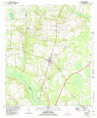
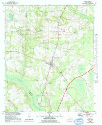
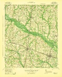
1982 Map of Olar
USGS Topo · Published 1983About this map
Olar serves as the central hub of this South Carolina landscape, where the Seaboard Coast Line railroad dictates the orientation of the town's grid. The surrounding countryside in Bamberg and Barnwell counties is defined by a dense network of spiritual and community landmarks, including Sweet Branch Ch, Georges Creek Ch, and St Phillip Ch. The low-lying geography is marked by the Little Salkehatchie River and several distinctive swampy depressions such as Alligator Bay, Horsepen Bay, and Cypress Pond. This survey, compiled from 1970s aerial photography, reveals a traditional coastal plain settlement pattern where small communities like Govan and Schofield are connected by rural routes crossing Juniper Creek and Georges Creek. Local history is preserved in the placement of many small cemeteries and church sites, such as Rosemary Ch and Starr Cem, which reflect the area's genealogical roots.
Find a feature on this map
36 named features on this map. Tap any name to fly to it.
Don’t see what you’re looking for? This feature index may not catch every label — zoom into the map to look around manually.
Map Details
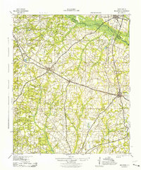
Editions of this 1982 Olar Map
2 editions found
Other maps of this area

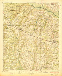
1919 · Olar
USGS Topo · 1:62,500

1919 · Bamberg
USGS Topo · 1:48,000

1919 · Allendale
USGS Topo · 1:62,500

1920 · Bamberg
USGS Topo · 1:62,500

1923 · Williston
USGS Topo · 1:48,000
1927 · Williston
USGS Topo · 1:62,500

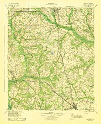
1943 · Olar
USGS Topo · 1:62,500
1943 · Allendale
USGS Topo · 1:62,500
1943 · Bamberg
USGS Topo · 1:62,500
1943 · Williston
USGS Topo · 1:62,500