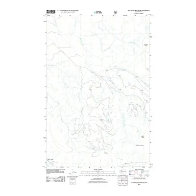
2011 Map of Old Baldy Mountain
USGS Topo · Published 2011About this map
Old Baldy Mountain and the high elevations of Carbon Ridge dominate this Pierce County landscape, where deep drainages and forest service access roads define the geography. The settlement of Upper Fairfax sits in the southwestern corner near the Carbon River, serving as a historical waypoint in a region primarily shaped by timber management and fire observation. Multiple lookout points, including O'Farrell Lookout and South Prairie Lookout, are positioned on prominent peaks to oversee the surrounding watersheds of South Prairie Creek, Wilkeson Creek, and Gale Creek. The terrain is characterized by steep elevation changes, rising toward distinctive summits like The Three Sisters and Burnt Mountain. A network of Forest Service routes, such as NFD 7710 RD and Nat For Dev RD 7720, provides the primary infrastructure through the heavily wooded ridges and valleys that feed into the larger river systems of the Carbon River basin.
Find a feature on this map
26 named features on this map. Tap any name to fly to it.
Don’t see what you’re looking for? This feature index may not catch every label — zoom into the map to look around manually.
Map Details
Editions of this 2011 Old Baldy Mountain Map
This is the sole edition of this map. No revisions or reprints were ever made.
Other maps of this area

1897 · Tacoma
USGS Topo · 1:125,000

1900 · Tacoma
USGS Topo · 1:125,000

1913 · Cedar Lake
USGS Topo · 1:125,000

1924 · Mt Rainier
USGS Topo · 1:96,000

1928 · Mt Rainier
USGS Topo · 1:125,000

1937 · Eatonville
USGS Topo · 1:125,000

1942 · Lake Tapps
USGS Topo · 1:62,500

1944 · Lake Tapps
USGS Topo · 1:62,500

1950 · Yakima
USGS Topo · 1:250,000

1953 · Hoquiam
USGS Topo · 1:250,000