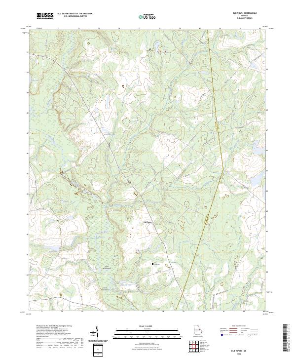
2024 Map of Old Town
USGS Topo · Published 2024About this map
Old Town sits at the heart of this landscape, positioned along the rural border where Jefferson and Burke counties meet. The terrain is defined by the winding course of the Ogeechee River and its complex network of tributaries, including Spring Creek, Three Runs, and Baker Branch. This modern survey reveals a countryside punctuated by small impoundments and natural features such as Wommack Lake, Union Camp Lake, and Boiling Spring. Settlement patterns here are tied to historic crossings and named agricultural points, notably the Upper Roundabout and Lower Roundabout south of the primary settlement. For those tracing family histories or land use in this part of Georgia, the inclusion of the Street Place Cem and Causey Cem provides specific points of reference for genealogical research within the patchwork of private timberlands and rural road networks like Eden Church Rd and Benefield Rd.
Find a feature on this map
44 named features on this map. Tap any name to fly to it.
Don’t see what you’re looking for? This feature index may not catch every label — zoom into the map to look around manually.
Map Details
Editions of this 2024 Old Town Map
This is the sole edition of this map. No revisions or reprints were ever made.
Other maps of this area

1919 · Gough
USGS Topo · 1:62,500

1920 · Stapleton
USGS Topo · 1:62,500

1948 · Stapleton
USGS Topo · 1:62,500

1948 · Gough
USGS Topo · 1:62,500

1948 · Louisville
USGS Topo · 1:24,000

1950 · Louisville
USGS Topo · 1:24,000
1950 · Gough
USGS Topo · 1:24,000

1950 · Kellys Pond
USGS Topo · 1:24,000

1953 · Athens
USGS Topo · 1:250,000

1957 · Macon
USGS Topo · 1:250,000