Loading...
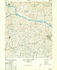
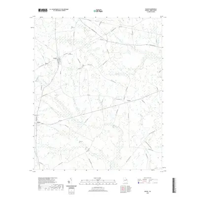
Loading map...1950 Map of Gough
USGS Topo · Published 1950About this map
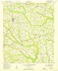
The settlement of Gough serves as a central hub in this agricultural landscape of Burke County, Georgia, defined by its position at the intersection of local roads and the Georgia and Florida railroad. The map reveals a deeply rooted rural community where family identity and spiritual life are anchored to the land, evidenced by the Gough Family Cemetery and Smith Family Cemetery. A distinct pattern of social organization is visible through landmarks like the Joan Society Hall and Cemetery and Tucker Grove Society Hall.
Find a feature on this map
35 named features on this map. Tap any name to fly to it.
Don’t see what you’re looking for? This feature index may not catch every label — zoom into the map to look around manually.
Map Details
Date Portrayed1950
Date Published1950
PublisherU.S. Geological Survey
Map TypeTopographic
Scale1:24,000
Physical Dimensions22 x 27 inches
Editions of this 1950 Gough Map
3 editions found
Historical Maps of Vidette Through Time
8 maps found
Featured Locations
Source Details
SourceU.S. Geological Survey
CopyrightPublic Domain