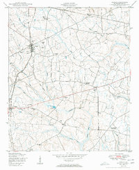
1950 Map of Gough
USGS Topo · Published 1950About this map
Agricultural life in Burke County centers on the rail-side community of Gough and the nearby village of Vidette at the mid-century. A network of family burial grounds, including the Gough Family Cemetery, Smith Family Cemetery, and Taylor Cemetery, indicates generations of established land ownership throughout the region. The landscape is dotted with numerous Windmills, highlighting a period when local water management was still largely decentralized.
Find a feature on this map
37 named features on this map. Tap any name to fly to it.
Don’t see what you’re looking for? This feature index may not catch every label — zoom into the map to look around manually.
Map Details
Editions of this 1950 Gough Map
3 editions found
Other maps of this area

1919 · Gough
USGS Topo · 1:62,500

1920 · Stapleton
USGS Topo · 1:62,500

1948 · Stapleton
USGS Topo · 1:62,500

1948 · Gough
USGS Topo · 1:62,500
1950 · Waynesboro
USGS Topo · 1:24,000
1950 · Gough
USGS Topo · 1:24,000
1950 · Storys Millpond
USGS Topo · 1:24,000
1950 · Keysville
USGS Topo · 1:24,000

1950 · Matthews
USGS Topo · 1:24,000

1950 · Kellys Pond
USGS Topo · 1:24,000