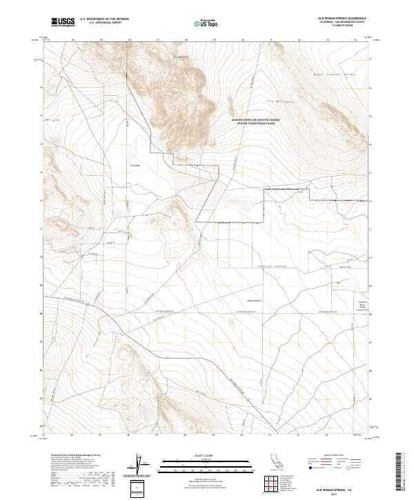
2021 Map of Old Woman Springs
USGS Topo · Published 2021About this map
Old Woman Springs and Cottonwood Spring provide critical water points in this arid reach of the Mojave Desert. The landscape is dominated by the Fry Mountains in the north, giving way to the expansive reaches of Johnson Valley and the Upper Johnson Valley. Human presence is marked by a network of desert roads and trails, including the historically significant Old Woman Springs Rd and the Bessemer Mine Rd, which hint at the region's mining and ranching legacy. Near the eastern boundary, the Abraham Ranch Airport sits as a solitary landmark against the desert floor. In the southern portion, Arrastre Cr cuts through the terrain, its name suggesting the presence of early ore-grinding sites. This survey captures a moment of modern desert habitation where remote ranches and rugged utility roads like Dune Rd intersect with the natural topography of Fry Valley.
Find a feature on this map
33 named features on this map. Tap any name to fly to it.
Don’t see what you’re looking for? This feature index may not catch every label — zoom into the map to look around manually.
Map Details
Editions of this 2021 Old Woman Springs Map
This is the sole edition of this map. No revisions or reprints were ever made.
Other maps of this area

1901 · Southern California Sheet No. 1
USGS Topo · 1:250,000

1902 · San Gorgonio
USGS Topo · 1:125,000

1904 · Southern California Sheet No. 1
USGS Topo · 1:250,000

1947 · Lucerne Valley
USGS Topo · 1:62,500

1949 · Lucerne Valley
USGS Topo · 1:62,500

1953 · San Bernardino
USGS Topo · 1:250,000

1955 · Old Woman Springs
USGS Topo · 1:62,500

1955 · Ord Mountains
USGS Topo · 1:62,500

1955 · Rodman Mountains
USGS Topo · 1:62,500

1956 · San Bernardino
USGS Topo · 1:250,000