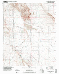
1999 Map of Old Woman Springs
USGS Topo · Published 2002About this map
The Old Woman Springs Ranch anchors this high-desert landscape in the late 20th century, marking a critical water source in a region defined by arid basins and isolation. Set against the northern edge of the Fry Mountains, the springs provided the necessary lifeblood for the Lafon Ranch and early settlement efforts. The map reveals a land structured by resource extraction and transportation, with the Bessemer Mine Road and Green Rock Mine Road cutting across the vast Johnson Valley toward the northern peaks.
Find a feature on this map
18 named features on this map. Tap any name to fly to it.
Don’t see what you’re looking for? This feature index may not catch every label — zoom into the map to look around manually.
Map Details
Editions of this 1999 Old Woman Springs Map
This is the sole edition of this map. No revisions or reprints were ever made.
Other maps of this area

1901 · Southern California Sheet No. 1
USGS Topo · 1:250,000

1902 · San Gorgonio
USGS Topo · 1:125,000

1904 · Southern California Sheet No. 1
USGS Topo · 1:250,000

1947 · Lucerne Valley
USGS Topo · 1:62,500

1949 · Lucerne Valley
USGS Topo · 1:62,500

1953 · San Bernardino
USGS Topo · 1:250,000

1955 · Old Woman Springs
USGS Topo · 1:62,500

1955 · Ord Mountains
USGS Topo · 1:62,500

1955 · Rodman Mountains
USGS Topo · 1:62,500

1956 · San Bernardino
USGS Topo · 1:250,000