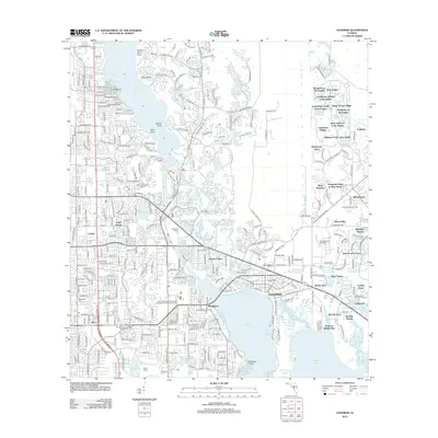
2012 Map of Oldsmar
USGS Topo · Published 2012About this map
Oldsmar sits at the northern terminus of Safety Harbor, appearing here as a complex landscape of residential growth and preserved shoreline. The town's historical connection to early 20th-century development is visible in the structured layouts of Reolds Acre and Reolds Farm, which contrast with the modern master-planned communities like Canterbury Village and Prestwick at The Eagles to the north. The area's recreational and utility infrastructure is well-documented, from the Florida Downs Racetrack near Mobbly Bayou to the Dunedin Lookout Tower and the City of Northeast Clearwater Wastewater Treatment Facility.
Find a feature on this map
295 named features on this map. Tap any name to fly to it.
Don’t see what you’re looking for? This feature index may not catch every label — zoom into the map to look around manually.
Map Details
Editions of this 2012 Oldsmar Map
This is the sole edition of this map. No revisions or reprints were ever made.
Other maps of this area

1921 · Sand Key
USGS Topo · 1:62,500

1921 · St Petersburg
USGS Topo · 1:62,500

1943 · Gandy Bridge
USGS Topo · 1:31,680

1943 · Safety Harbor
USGS Topo · 1:31,680

1943 · Dunedin
USGS Topo · 1:31,680

1943 · Tarpon Springs
USGS Topo · 1:31,680

1943 · Clearwater
USGS Topo · 1:24,000

1943 · Odessa
USGS Topo · 1:24,000

1943 · Elfers
USGS Topo · 1:24,000

1943 · Oldsmar
USGS Topo · 1:24,000