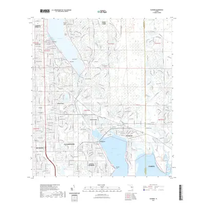
2021 Map of Oldsmar
USGS Topo · Published 2021About this map
Lake Tarpon and the intricate coastal estuaries of Old Tampa Bay dominate this landscape, documenting the modern suburban density of Pinellas County. The map details the transition from the resort and golf-centered community of Innisbrook in the northwest to the industrial and residential corridors of Oldsmar in the southeast. Notable landmarks like the Parklawn Memorial Cem and the Central Florida Institute reflect the community's established social infrastructure alongside older geographic features like Philippe Point and Wall Point.
Find a feature on this map
302 named features on this map. Tap any name to fly to it.
Don’t see what you’re looking for? This feature index may not catch every label — zoom into the map to look around manually.
Map Details
Editions of this 2021 Oldsmar Map
This is the sole edition of this map. No revisions or reprints were ever made.
Other maps of this area

1921 · Sand Key
USGS Topo · 1:62,500

1921 · St Petersburg
USGS Topo · 1:62,500

1943 · Gandy Bridge
USGS Topo · 1:31,680

1943 · Safety Harbor
USGS Topo · 1:31,680

1943 · Dunedin
USGS Topo · 1:31,680

1943 · Tarpon Springs
USGS Topo · 1:31,680

1943 · Clearwater
USGS Topo · 1:24,000

1943 · Odessa
USGS Topo · 1:24,000

1943 · Elfers
USGS Topo · 1:24,000

1943 · Oldsmar
USGS Topo · 1:24,000