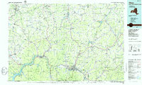
1986 Map of Olean
USGS Topo · Published 1986About this map
The Allegany Indian Reservation and Cornplanter Indian State Reservation Park define the southern corridor of this map, flanking the river valley near Salamanca. The landscape is a transition from the industrial and academic hub of Olean, featuring St Bonaventure University, to the specialized utility of the Western New York Nuclear Service Center in the north. Extensive Oil Field designations near the Pennsylvania border highlight the region's long history with resource extraction.
Find a feature on this map
395 named features on this map. Tap any name to fly to it.
Don’t see what you’re looking for? This feature index may not catch every label — zoom into the map to look around manually.
Map Details
Editions of this 1986 Olean Map
2 editions found
Other maps of this area

1898 · Olean
USGS Topo · 1:62,500

1899 · Silver Creek
USGS Topo · 1:62,500

1900 · Cherry Creek
USGS Topo · 1:62,500

1900 · Salamanca
USGS Topo · 1:62,500

1905 · Jamestown
USGS Topo · 1:62,500

1905 · Portage
USGS Topo · 1:62,500

1905 · Nunda
USGS Topo · 1:62,500

1905 · Eden
USGS Topo · 1:62,500

1906 · Warren
USGS Topo · 1:62,500

1906 · Angelica
USGS Topo · 1:62,500