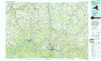
1986 Map of Olean
USGS Topo · Published 1994About this map
St Bonaventure University and the city of Olean anchor this mid-1980s look at the borderlands where New York meets Pennsylvania. The Allegheny River winds through the southern reaches, connecting the Allegany State Park and the Allegheny Reservoir with historic settlements like Salamanca and Portville. The map illustrates a complex landscape of valley floors and high ridges, including The Narrows and the dramatic Zoar Valley near Gowanda.
Find a feature on this map
273 named features on this map. Tap any name to fly to it.
Don’t see what you’re looking for? This feature index may not catch every label — zoom into the map to look around manually.
Map Details
Editions of this 1986 Olean Map
2 editions found
Other maps of this area

1898 · Olean
USGS Topo · 1:62,500

1899 · Silver Creek
USGS Topo · 1:62,500

1900 · Cherry Creek
USGS Topo · 1:62,500

1900 · Salamanca
USGS Topo · 1:62,500

1905 · Jamestown
USGS Topo · 1:62,500

1905 · Portage
USGS Topo · 1:62,500

1905 · Nunda
USGS Topo · 1:62,500

1905 · Eden
USGS Topo · 1:62,500

1906 · Warren
USGS Topo · 1:62,500

1906 · Angelica
USGS Topo · 1:62,500