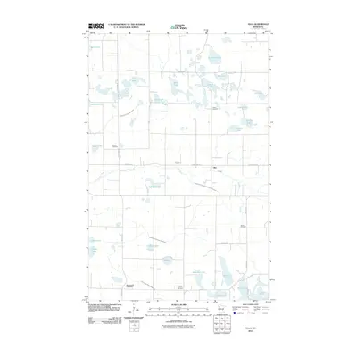
2010 Map of Olga
USGS Topo · Published 2010About this map
The Olga settlement sits at a rural crossroads in Polk County, where the meandering Hill River cuts through a landscape defined by glacial lakes and a regulated drainage system. This 2010 survey illustrates the deep-rooted community history of the region, anchored by numerous burial grounds including Salem Cemetery, Zion Cemetery, and the Froen Lutheran Cemetery. The township's water-rich terrain features distinctive bodies such as Schneider Lake and Sawmill Lake, many of which are connected or managed by a complex network of ditches like County Ditch Number 113 and County Ditch Number 59. These man-made channels reflect the agricultural evolution of the area, as settlers worked to manage the wetlands for farming. This map is a critical resource for genealogists researching family names associated with the local lakes and the many country cemeteries scattered across the township's sections.
Find a feature on this map
43 named features on this map. Tap any name to fly to it.
Don’t see what you’re looking for? This feature index may not catch every label — zoom into the map to look around manually.
Map Details
Editions of this 2010 Olga Map
This is the sole edition of this map. No revisions or reprints were ever made.
Other maps of this area

1919 · Fosston
USGS Topo · 1:62,500

1919 · Grit
USGS Topo · 1:62,500

1919 · Winsor
USGS Topo · 1:62,500

1954 · Bemidji
USGS Topo · 1:250,000

1957 · Bemidji
USGS Topo · 1:250,000

1958 · Bemidji
USGS Topo · 1:250,000

1969 · Olga
USGS Topo · 1:24,000

1969 · Mc Intosh NE
USGS Topo · 1:24,000

1969 · Fosston SE
USGS Topo · 1:24,000

1969 · Fosston East
USGS Topo · 1:24,000