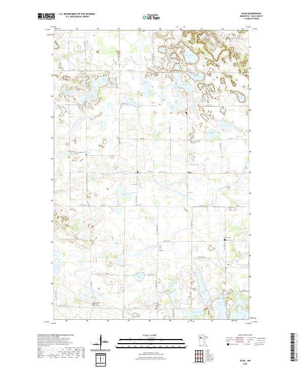
2022 Map of Olga
USGS Topo · Published 2022About this map
The Hill River meanders through this portion of Polk County, where a legacy of land reclamation is visible in the extensive network of engineered waterways such as County Ditch Number One Hundred Thirteen and County Ditch Number Eightyfour. These channels represent a significant modification of the natural landscape to support agriculture in a region densely populated with small glacial water bodies like Schneider Lake and Sorby Lake. Settlement is sparse, anchored by the community of Olga. For genealogists and local historians, the area is notable for its numerous rural burial grounds, including the Brandvold Cemetery and the Froen Lutheran Cem, which reflect the early Scandinavian-American congregations that established themselves across these townships. The map documents a landscape defined by its grid of country roads and the persistent management of its marshy terrain.
Find a feature on this map
54 named features on this map. Tap any name to fly to it.
Don’t see what you’re looking for? This feature index may not catch every label — zoom into the map to look around manually.
Map Details
Editions of this 2022 Olga Map
This is the sole edition of this map. No revisions or reprints were ever made.
Other maps of this area

1919 · Fosston
USGS Topo · 1:62,500

1919 · Grit
USGS Topo · 1:62,500

1919 · Winsor
USGS Topo · 1:62,500

1954 · Bemidji
USGS Topo · 1:250,000

1957 · Bemidji
USGS Topo · 1:250,000

1958 · Bemidji
USGS Topo · 1:250,000

1969 · Olga
USGS Topo · 1:24,000

1969 · Mc Intosh NE
USGS Topo · 1:24,000

1969 · Fosston SE
USGS Topo · 1:24,000

1969 · Fosston East
USGS Topo · 1:24,000