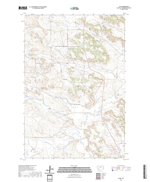
2024 Map of Olive
USGS Topo · Published 2024About this map
The tiny settlement of Olive serves as the focal point of this Powder River County landscape, where the high plains are carved by an intricate network of seasonal drainages. The hydrology of the region is defined by Mizpah Creek, which winds through the southern and eastern sections of the quadrangle, joined by tributaries such as Wolf Creek and Road Creek. This area of eastern Montana is characterized by its large-scale ranching and land management divisions, reflected in the precise section lines of Townships like t3s r50e.
Find a feature on this map
22 named features on this map. Tap any name to fly to it.
Don’t see what you’re looking for? This feature index may not catch every label — zoom into the map to look around manually.
Map Details
Editions of this 2024 Olive Map
This is the sole edition of this map. No revisions or reprints were ever made.
Other maps of this area

1954 · Ekalaka
USGS Topo · 1:250,000

1956 · Ekalaka
USGS Topo · 1:250,000

1958 · Ekalaka
USGS Topo · 1:250,000

1965 · Ekalaka
USGS Topo · 1:250,000

1973 · Olive
USGS Topo · 1:24,000

1973 · Moonlight Creek
USGS Topo · 1:24,000

1973 · Box Elder Creek
USGS Topo · 1:24,000

1973 · Coalwood
USGS Topo · 1:24,000
1973 · Leslie Creek
USGS Topo · 1:24,000
1973 · Broadus
USGS Topo · 1:24,000