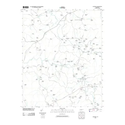
2010 Map of Olivehill
USGS Topo · Published 2010About this map
Hardin Creek and its many winding tributaries, including Indian Creek and the Hulin Branch, dominate this landscape in the hills of Wayne County. The map reveals a deeply etched terrain of hollows and ridges, such as Backbone Ridge and Blackshire Ridge, where human activity is often defined by the waterway crossings. Numerous river crossings are documented here, from Johnson Ford in the north to Whitten Ford and Bryant Ford further south, illustrating the traditional transit routes through this part of Tennessee.
Find a feature on this map
176 named features on this map. Tap any name to fly to it.
Don’t see what you’re looking for? This feature index may not catch every label — zoom into the map to look around manually.
Map Details
Editions of this 2010 Olivehill Map
This is the sole edition of this map. No revisions or reprints were ever made.
Other maps of this area

1905 · Waynesboro
USGS Topo · 1:125,000

1936 · Savannah
USGS Topo · 1:24,000

1936 · Wolf Pit Ridge
USGS Topo · 1:24,000

1936 · Hookers Bend
USGS Topo · 1:24,000

1936 · Eagle Creek
USGS Topo · 1:24,000

1936 · Thurman
USGS Topo · 1:24,000

1936 · Olivehill
USGS Topo · 1:24,000

1936 · Bath Springs
USGS Topo · 1:24,000

1936 · Clifton
USGS Topo · 1:24,000

1936 · Martins Mills
USGS Topo · 1:24,000