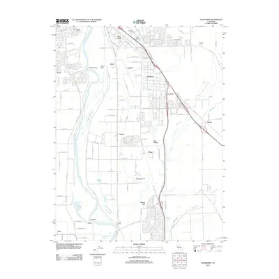
2012 Map of Olivehurst
USGS Topo · Published 2012About this map
The Feather River defines the landscape of this 2012 Yuba County survey, winding past a series of riverfront features including Shanghai Bend, Eliza Bend, and Star Bend. The eastern bank shows significant suburban development in Olivehurst, Linda, and the newer communities of Plumas Lake and Arboga. This era represents a period of substantial residential expansion between the river and the older agricultural infrastructure. Transportation and commerce are centered around the Yuba County Airport and Rupert Siding, while recreational and social landmarks like the Marysville Municipal Golf Course and Sierra View Memorial Park serve the growing population. Along the river’s edge, historic points such as Starrs Landing and Plumas Landing hint at the area's long-standing connection to river traffic and small-scale shipping.
Find a feature on this map
100 named features on this map. Tap any name to fly to it.
Don’t see what you’re looking for? This feature index may not catch every label — zoom into the map to look around manually.
Map Details
Editions of this 2012 Olivehurst Map
This is the sole edition of this map. No revisions or reprints were ever made.
Other maps of this area

1888 · Marysville
USGS Topo · 1:125,000

1888 · Smartsville
USGS Topo · 1:125,000

1891 · Sacramento
USGS Topo · 1:125,000

1891 · Marysville
USGS Topo · 1:125,000

1891 · Smartsville
USGS Topo · 1:125,000

1892 · Sacramento
USGS Topo · 1:125,000

1892 · Smartsville
USGS Topo · 1:125,000

1893 · Sacramento
USGS Topo · 1:125,000

1894 · Smartsville
USGS Topo · 1:125,000

1894 · Marysville
USGS Topo · 1:125,000