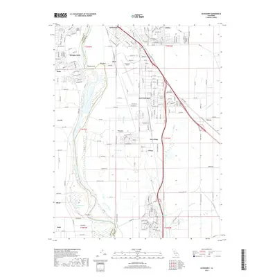
2018 Map of Olivehurst
USGS Topo · Published 2018About this map
The Feather River defines the western edge of this landscape, winding through a complex of riparian features like Abbott Lake, O'Connor Lakes, and the sweeping curve of Star Bend. In the late 2010s, this area south of Yuba City shows a clear transition from dense suburban development in Olivehurst and Linda to the expansive agricultural tracts around Arboga and East Arboga. The influence of transportation is evident in the Union Pacific rail lines and the presence of both the Sutter County Airport and Yuba County Airport. Smaller, historically distinct locales such as Pearson, Alicia, and Ostrom remain visible as established nodes within the larger valley drainage system, where local waterways like Clark Slough and Algoda Slough traverse the low-lying plains.
Find a feature on this map
117 named features on this map. Tap any name to fly to it.
Don’t see what you’re looking for? This feature index may not catch every label — zoom into the map to look around manually.
Map Details
Editions of this 2018 Olivehurst Map
This is the sole edition of this map. No revisions or reprints were ever made.
Other maps of this area

1888 · Marysville
USGS Topo · 1:125,000

1888 · Smartsville
USGS Topo · 1:125,000

1891 · Sacramento
USGS Topo · 1:125,000

1891 · Marysville
USGS Topo · 1:125,000

1891 · Smartsville
USGS Topo · 1:125,000

1892 · Sacramento
USGS Topo · 1:125,000

1892 · Smartsville
USGS Topo · 1:125,000

1893 · Sacramento
USGS Topo · 1:125,000

1894 · Smartsville
USGS Topo · 1:125,000

1894 · Marysville
USGS Topo · 1:125,000