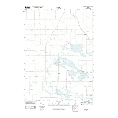
2010 Map of Oliver Lake
USGS Topo · Published 2010About this map
Oliver Lake and its surrounding chain of glacial waters dominate this landscape north of Wolcottville. The area's intricate hydrography is defined by a dense cluster of interconnected lakes, including Dallas Lake, Witmer Lake, Westler Lake, and Hackenburg Lake, many of which are linked by the North Branch Elkhart River. This concentration of water bodies suggests a long-standing history of seasonal recreation and lakeside settlement. Away from the shorelines, the terrain transitions into a structured grid of rural roads and family-named landmarks. Genealogists will find numerous small burial grounds dispersed through the countryside, such as Osborn Cemetery, Jordon Cemetery, Sloan Cemetery, and Miller Cemetery. Small communities like Valentine and Eddy anchor the road network, while the Oliver Lake Airport serves as a distinct local landmark in the lake district.
Find a feature on this map
81 named features on this map. Tap any name to fly to it.
Don’t see what you’re looking for? This feature index may not catch every label — zoom into the map to look around manually.
Map Details
Editions of this 2010 Oliver Lake Map
This is the sole edition of this map. No revisions or reprints were ever made.
Other maps of this area

1947 · Mongo
USGS Topo · 1:24,000

1947 · Lagrange
USGS Topo · 1:24,000

1947 · Wolcottville
USGS Topo · 1:24,000

1947 · Oliver Lake
USGS Topo · 1:24,000

1953 · Fort Wayne
USGS Topo · 1:250,000

1955 · Kendallville
USGS Topo · 1:24,000

1956 · Fort Wayne
USGS Topo · 1:250,000

1956 · Ligonier
USGS Topo · 1:24,000

1956 · Albion
USGS Topo · 1:24,000

1959 · Wolcottville
USGS Topo · 1:24,000