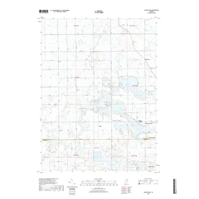
2019 Map of Oliver Lake
USGS Topo · Published 2019About this map
The glacial lakes and marshy headwaters of the North Branch Elkhart River dominate this portion of Northeastern Indiana. The landscape is defined by its complex hydrography, featuring large bodies like Oliver Lake, Witmer Lake, and Dallas Lake, alongside smaller, tucked-away features such as Pond Lil and Smith Hole. The boundary between Lagrange and Noble counties bisects the southern half of the map, where the settlement of Wolcottville straddles the line. Genealogists will find a high concentration of burial grounds throughout the rural townships, including Osborn Cem, Sloan Cem, and Beulah Cem. The presence of the Delt Church Park Trail suggests a focus on modern recreational conservation within this traditional wetland and agricultural corridor. Small lakeside communities like Webers Landing and Witmer Manor illustrate the localized development clustered around the regional water systems.
Find a feature on this map
52 named features on this map. Tap any name to fly to it.
Don’t see what you’re looking for? This feature index may not catch every label — zoom into the map to look around manually.
Map Details
Editions of this 2019 Oliver Lake Map
This is the sole edition of this map. No revisions or reprints were ever made.
Other maps of this area

1947 · Mongo
USGS Topo · 1:24,000

1947 · Lagrange
USGS Topo · 1:24,000

1947 · Wolcottville
USGS Topo · 1:24,000

1947 · Oliver Lake
USGS Topo · 1:24,000

1953 · Fort Wayne
USGS Topo · 1:250,000

1955 · Kendallville
USGS Topo · 1:24,000

1956 · Fort Wayne
USGS Topo · 1:250,000

1956 · Ligonier
USGS Topo · 1:24,000

1956 · Albion
USGS Topo · 1:24,000

1959 · Wolcottville
USGS Topo · 1:24,000