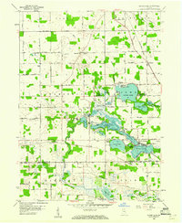
1959 Map of Oliver Lake
USGS Topo · Published 1961About this map
Indian Lakes and the surrounding marshlands of LaGrange and Noble counties define this glacial landscape, captured here as it appeared in the late 1950s. The chain of water bodies, including Oliver Lake, Dallas Lake, and Witmer Lake, supported a thriving recreation economy evidenced by the presence of Purdue University Limberlost Camp, a YWCA Camp, and Camp Okalona. The mapping reflects a period when the Pennsylvania and Wabash railroads still traversed the countryside, connecting small settlements like Wolcottville and Valentine to larger regional markets.
Find a feature on this map
62 named features on this map. Tap any name to fly to it.
Don’t see what you’re looking for? This feature index may not catch every label — zoom into the map to look around manually.
Map Details
Editions of this 1959 Oliver Lake Map
This is the sole edition of this map. No revisions or reprints were ever made.
Other maps of this area

1947 · Mongo
USGS Topo · 1:24,000

1947 · Lagrange
USGS Topo · 1:24,000

1947 · Wolcottville
USGS Topo · 1:24,000

1947 · Oliver Lake
USGS Topo · 1:24,000

1953 · Fort Wayne
USGS Topo · 1:250,000

1955 · Kendallville
USGS Topo · 1:24,000

1956 · Fort Wayne
USGS Topo · 1:250,000

1956 · Ligonier
USGS Topo · 1:24,000

1956 · Albion
USGS Topo · 1:24,000

1959 · Wolcottville
USGS Topo · 1:24,000