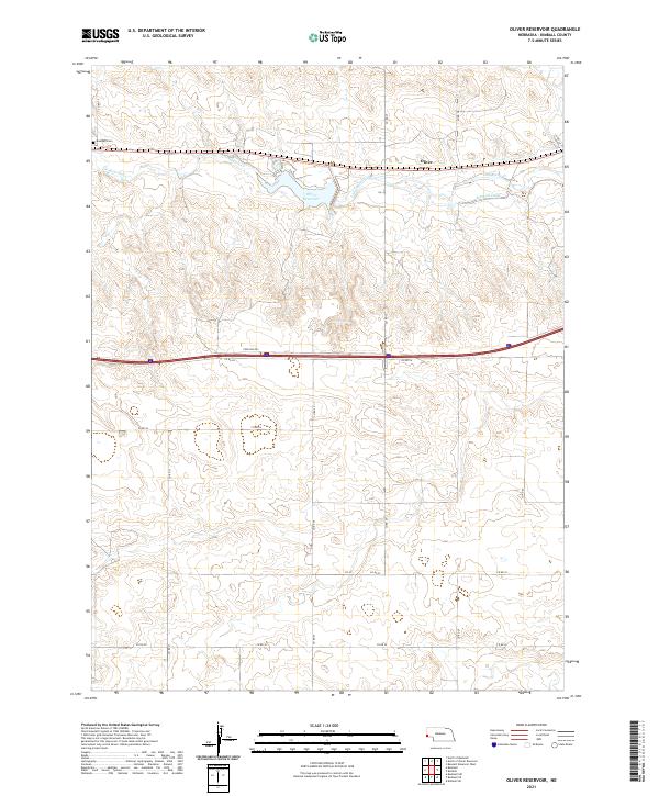
2021 Map of Oliver Reservoir
USGS Topo · Published 2021About this map
Oliver Reservoir serves as a central hydrological feature in this High Plains landscape, managed through an intricate system of water control. The Kimball Canal and the winding course of Lodgepole Cr define the movement of water across the terrain, supporting the agricultural needs of Kimball County. The small settlement of Oliver is situated just north of the reservoir along a network of numbered county roads, reflecting the grid-based development of western Nebraska. For family historians, the Bushnell Cem is a significant landmark located in the northwestern portion of the map, providing a point of reference for early inhabitants. The area is characterized by low-relief topography, with numerous small depressions and local roads like Forsling Rd connecting the scattered homesteads and ranches that populate the townships of t15n r57w and t14n r56w.
Find a feature on this map
24 named features on this map. Tap any name to fly to it.
Don’t see what you’re looking for? This feature index may not catch every label — zoom into the map to look around manually.
Map Details
Editions of this 2021 Oliver Reservoir Map
This is the sole edition of this map. No revisions or reprints were ever made.
Other maps of this area

1954 · Scottsbluff
USGS Topo · 1:250,000

1958 · Scottsbluff
USGS Topo · 1:250,000
1972 · Bushnell SW
USGS Topo · 1:24,000

1972 · Kimball SW
USGS Topo · 1:24,000

1972 · Bushnell
USGS Topo · 1:24,000

1972 · Kimball
USGS Topo · 1:24,000

1972 · Bushnell SE
USGS Topo · 1:24,000

1972 · Oliver Reservoir
USGS Topo · 1:24,000

1973 · Kimball 2 SE
USGS Topo · 1:24,000
1973 · Kimball 2 SW
USGS Topo · 1:24,000