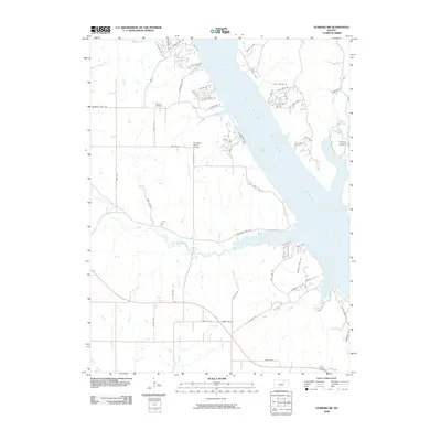
2009 Map of Olsburg SW
USGS Topo · Published 2009About this map
Tuttle Creek Lake dominates the landscape of this Riley County region, carving through the terrain with significant inlets like Mill Cove. The eastern shore features residential developments with network-like street patterns such as Golden Shores Dr and the lakeside properties along Harbour Haven Dr. This era shows a mix of recreational shoreline use and established agricultural roots, evident in the presence of family-linked landmarks like the Carnahan-Garrison Cemetery and Hohman Cemetery.
Find a feature on this map
55 named features on this map. Tap any name to fly to it.
Don’t see what you’re looking for? This feature index may not catch every label — zoom into the map to look around manually.
Map Details
Editions of this 2009 Olsburg SW Map
This is the sole edition of this map. No revisions or reprints were ever made.
Other maps of this area

1886 · Junction City
USGS Topo · 1:125,000

1889 · Junction City
USGS Topo · 1:125,000

1894 · Junction City
USGS Topo · 1:125,000

1947 · Manhattan
USGS Topo · 1:62,500

1947 · Fort Riley
USGS Topo · 1:62,500

1950 · Keats
USGS Topo · 1:24,000

1950 · Manhattan
USGS Topo · 1:24,000

1951 · Wind Creek
USGS Topo · 1:24,000

1955 · Fort Riley NE
USGS Topo · 1:24,000
1955 · Manhattan
USGS Topo · 1:24,000