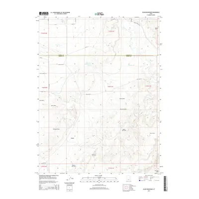
2014 Map of Olsen Reservoir
USGS Topo · Published 2014About this map
The settlement of Victor sits on the southern edge of the Carbon and Emery county line, an area defined by its complex network of seasonal drainages and irrigation history. This 2014 survey documents the enduring presence of the Old Victor Cem, providing a crucial point of reference for genealogists tracing families in this part of the San Rafael Swell region. The landscape is dominated by erosional features such as Washboard Wash, Marsing Wash, and Desert Seep Wash, which channel water toward the Price River in the northeast. Human alteration of the arid terrain is evident in the Olsen Reservoir and the Desert Lake N Ditch, reflecting the long-standing efforts to manage water for agriculture and livestock. Notable topographic landmarks like Mounds Reef and Church Flats help define the varied elevation across this desert expanse.
Find a feature on this map
32 named features on this map. Tap any name to fly to it.
Don’t see what you’re looking for? This feature index may not catch every label — zoom into the map to look around manually.
Map Details
Editions of this 2014 Olsen Reservoir Map
This is the sole edition of this map. No revisions or reprints were ever made.
Other maps of this area

1886 · Price River
USGS Topo · 1:250,000

1896 · Price River
USGS Topo · 1:250,000

1914 · Castle Gate
USGS Topo · 1:62,500

1915 · Wellington
USGS Topo · 1:62,500

1916 · Castle Gate
USGS Topo · 1:62,500

1956 · Price
USGS Topo · 1:250,000

1960 · Price
USGS Topo · 1:250,000

1962 · Price
USGS Topo · 1:250,000

1969 · Olsen Reservoir
USGS Topo · 1:24,000

1969 · Elmo
USGS Topo · 1:24,000