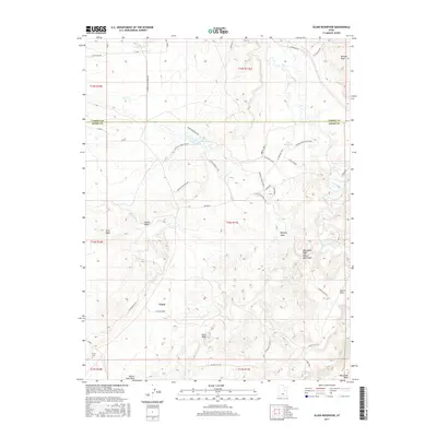
2017 Map of Olsen Reservoir
USGS Topo · Published 2017About this map
Victor lies at the heart of this landscape along the border of Carbon and Emery Counties, serving as a focal point for local history and genealogy. The terrain is defined by a network of drainage systems and reservoirs essential to life in this arid region, including Olsen Reservoir and the winding course of the Price River. Early 21st-century infrastructure is evident through named ranching landmarks like the Marsing / Hansen Ranch and numerous access roads such as Mound Rd and Church Flat Rd. Cultural markers like the Victor Cem provide a direct link to the area's residents, while geological features such as Mounds Reef and Marsing Wash illustrate the complex topography of the San Rafael Swell area. The irrigation legacy of the region is further marked by the Desert Lake N Ditch and the Allen Ditch Rd in the northwest.
Find a feature on this map
44 named features on this map. Tap any name to fly to it.
Don’t see what you’re looking for? This feature index may not catch every label — zoom into the map to look around manually.
Map Details
Editions of this 2017 Olsen Reservoir Map
This is the sole edition of this map. No revisions or reprints were ever made.
Other maps of this area

1886 · Price River
USGS Topo · 1:250,000

1896 · Price River
USGS Topo · 1:250,000

1914 · Castle Gate
USGS Topo · 1:62,500

1915 · Wellington
USGS Topo · 1:62,500

1916 · Castle Gate
USGS Topo · 1:62,500

1956 · Price
USGS Topo · 1:250,000

1960 · Price
USGS Topo · 1:250,000

1962 · Price
USGS Topo · 1:250,000

1969 · Olsen Reservoir
USGS Topo · 1:24,000

1969 · Elmo
USGS Topo · 1:24,000