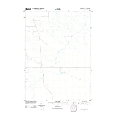
2012 Map of Olsonville SE
USGS Topo · Published 2012About this map
Rock Creek meanders extensively through the central and southern portions of this landscape in the Antelope Segment of Todd County. The 2012 survey by the U.S. Geological Survey shows a predominantly open terrain defined by drainage patterns and a sparse network of section roads. A primary transit corridor is established by Highway 83, which cuts vertically through the western half of the map, providing a modern connection across the plains. In the eastern portion, Littleburg Road serves as a significant local artery. This topographic study emphasizes the water-scarce environment of South Dakota, where the intricate branching of Rock Creek forms the primary geographic landmark for researchers and residents alike.
Find a feature on this map
3 named features on this map. Tap any name to fly to it.
Don’t see what you’re looking for? This feature index may not catch every label — zoom into the map to look around manually.
Map Details
Editions of this 2012 Olsonville SE Map
This is the sole edition of this map. No revisions or reprints were ever made.
Other maps of this area

1950 · Sparks
USGS Topo · 1:62,500

1950 · Valentine
USGS Topo · 1:62,500

1955 · Martin
USGS Topo · 1:250,000

1957 · Valentine
USGS Topo · 1:250,000

1958 · Martin
USGS Topo · 1:250,000

1959 · Valentine
USGS Topo · 1:250,000

1969 · Olsonville NW
USGS Topo · 1:24,000

1969 · Olsonville SW
USGS Topo · 1:24,000

1982 · Olsonville
USGS Topo · 1:24,000

1982 · Olsonville SE
USGS Topo · 1:24,000
Featured Places
- Antelope Segment, SD
- Rosebud, Antelope Segment
- Sicangu Village, Antelope Segment
- Todd County, SD
- United States