
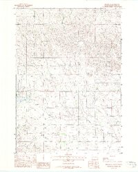
1969 Map of Olsonville NW
USGS Topo · Published 1972About this map
The Rosebud Indian Reservation lands in South Dakota are documented here during a 1969 field check, revealing a landscape defined by its essential water sources and extensive boundary lines. The perennial flow of Antelope Creek meanders through the eastern portion of the quadrangle, serving as a primary hydrological feature in this rural expanse of Todd County. Away from the creek beds, the map identifies specific points of access to groundwater, such as several marked instances of Well and natural Spring outlets. These features were critical for the homesteads and cattle operations of the era, where survival depended on localized water availability. The survey also captures human organization of the land through fine red dashed lines indicating selected fence and field boundaries visible from 1966 aerial photography, providing a detailed record of land use and enclosure within the reservation during the late twentieth century.
Find a feature on this map
5 named features on this map. Tap any name to fly to it.
Don’t see what you’re looking for? This feature index may not catch every label — zoom into the map to look around manually.
Map Details
Editions of this 1969 Olsonville NW Map
This is the sole edition of this map. No revisions or reprints were ever made.
Other maps of this area

1955 · Martin
USGS Topo · 1:250,000

1958 · Martin
USGS Topo · 1:250,000

1969 · Mission
USGS Topo · 1:24,000

1969 · Soldier Creek SE
USGS Topo · 1:24,000

1969 · Rosebud
USGS Topo · 1:24,000

1969 · Olsonville SW
USGS Topo · 1:24,000

1969 · St. Francis SE
USGS Topo · 1:24,000

1982 · Olsonville
USGS Topo · 1:24,000

1982 · Olsonville SE
USGS Topo · 1:24,000
1982 · Mission SE
USGS Topo · 1:24,000