
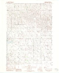
1969 Map of Mission
USGS Topo · Published 1971About this map
Mission and the neighboring settlement of Antelope serve as the focal points for this study of Todd County during the late 1960s. Located entirely within the Rosebud Indian Reservation, the landscape is defined by the headwaters of several drainages, including Antelope Creek and Horse Creek, which originate near the prominent Table Butte to the northwest. The map documents the community infrastructure of the era, from the Mission Sioux Airport and a local Substation to social and recreational landmarks like Kimmel Park and the Mission Golf Course.
Find a feature on this map
27 named features on this map. Tap any name to fly to it.
Don’t see what you’re looking for? This feature index may not catch every label — zoom into the map to look around manually.
Map Details
Editions of this 1969 Mission Map
This is the sole edition of this map. No revisions or reprints were ever made.
Other maps of this area

1955 · Martin
USGS Topo · 1:250,000

1958 · Martin
USGS Topo · 1:250,000

1969 · Soldier Creek NE
USGS Topo · 1:24,000

1969 · Mission NW
USGS Topo · 1:24,000

1969 · Soldier Creek SE
USGS Topo · 1:24,000

1969 · Olsonville NW
USGS Topo · 1:24,000

1969 · Rosebud
USGS Topo · 1:24,000

1982 · Mission NE
USGS Topo · 1:24,000

1982 · Olsonville
USGS Topo · 1:24,000
1982 · Mission SE
USGS Topo · 1:24,000
Featured Places
- Rosebud, SD
- Mission, Antelope Segment
- Antelope Development Area, Antelope Segment
- Antelope, Antelope Segment
- Antelope Segment, SD